libE57 Best Practices
This is a list of the best practices on interupting the E2807 standard and using the libE57 library.
THE SOFTWARE IS PROVIDED "AS IS", WITHOUT WARRANTY OF ANY KIND, EXPRESS OR IMPLIED, INCLUDING BUT NOT LIMITED TO THE WARRANTIES OF MERCHANTABILITY, FITNESS FOR A PARTICULAR PURPOSE, TITLE AND NON-INFRINGEMENT. IN NO EVENT SHALL THE COPYRIGHT HOLDERS OR ANYONE DISTRIBUTING THE SOFTWARE BE LIABLE FOR ANY DAMAGES OR OTHER LIABILITY, WHETHER IN CONTRACT, TORT OR OTHERWISE, ARISING FROM, OUT OF OR IN CONNECTION WITH THE SOFTWARE OR THE USE OR OTHER DEALINGS IN THE SOFTWARE.
Click each item to expand its details.
Coordinate systems used in libE57
-
XYZ - Cartesian Coordinates
X, Y, Z - Points in cartesian coordinates are represented by an ordered triple (x, y, z) where x, y and z are coordinates along the X, Y, Z axis, respectively. The Z-axis is in the UP direction, the Y-axis is the northing and X-axis is the easting. The coordinate system is right-handed and is measured in meters. If a lidar scanner uses a left-handed system, the data should be converted into this right-handed definition.
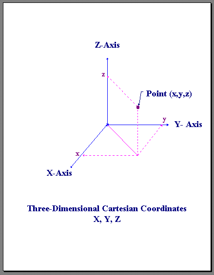
X,Y,Z Cartesian Coordinates
-
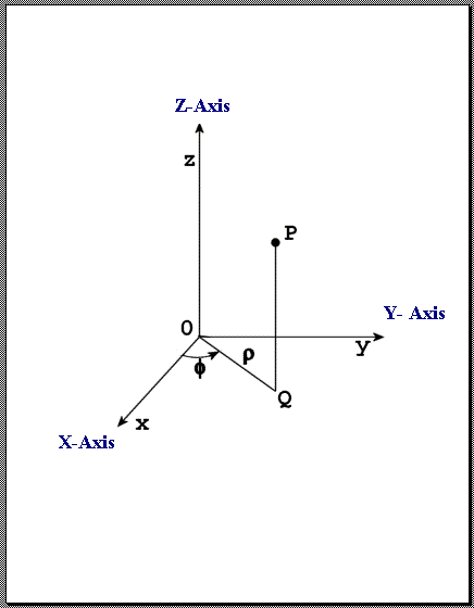
CYL - Cylindrical Coordinates
Radial (ρ), Azimuth (θ), Z - Points in cylindrical coordinates are represented by an ordered triplet (ρ,θ,z), where ρ is the radial distance (in meters), θ is the azimuth angle (in radians), and z is the height (in meters).
The following restrictions on cylindrical coordinates are applied:
ρ >= 0
-π < θ <= π
Radial, Azimuth, and Z Coordinates
-
RAE - Spherical Coordinates
Range (r), Azimuth (θ), Elevation (φ) - Points in spherical coordinates are represented by an ordered triplet ( r, θ, φ), where r is the range (in meters), θ is the azimuth angle (in radians), and φ is the elevation angle (in radians). The azimuth angle is measured as the counterclock-wise rotation of the positive X-axis about the positive Z-axis of a Cartesian reference frame.
The following restrictions on spherical coordinates are applied:
r >= 0
-π < θ <= π
-π/2 <= φ <= π/2
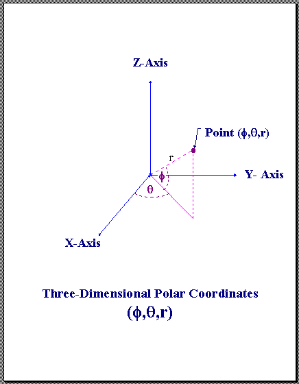
Range, Azimuth, and Elevation Coordinates
-
Conversion between XYZ and CYL Coordinates
The conversion between cylindrical and cartesian coordinates are accomplished through the formulas:
x = ρ cos( θ )
y = ρ sin( θ )
z = z
ρ = √ x2 + y2
θ = arctan2( y, x )
z = z
-
Conversion between XYZ and RAE Coordinates
The conversion between spherical and cartesian coordinates are accomplished through the formulas:
x = r cos( φ ) cos( θ )
y = r cos( φ ) sin( θ )
z = r sin( φ )
r = √ x2 + y2 + z2
θ = arctan2( y, x )
φ = arcsin( z / r )
-
Scanner Coordinate System
The Scanner's coordinate system is defined by the manufacturer of the scanner. The Pose/Translation vector is the position of the scanner's nodal point (origin) in the World Coordinate System of the E57 file.
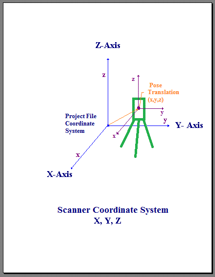
Scanner Coordinate System
E57 Writer Best Practices
-
IndexBounds and Structured Point Clouds
The standard states that the bounds are defined to be tight. In table 28, the standard defines rowMaximum to be "The maximum rowIndex value of any point represented by this IndexBounds object." The problem with this is that it doesn't meet the real world needs for structured point clouds.
One of the best ways to judge a standard is its ability to round-trip the data completely. Given a PTX (size 100,100) file of a scan where rows 92 to 100 were all invalid, converting this to E57 and dropping out all of the invalid points and converting it back to PTX (size 91,100) would NOT reproduce the identical file. It would be short rows 92 to 100. The current standard fails the test.
The best way to solve this problem is to set the IndexBounds to the grid size of the structured point cloud like this:
//  SimpleAPI
	e57::Data3D header;
...
	header.indexBounds.rowMaximum = nSizeRows - 1;
	header.indexBounds.rowMinimum = 0;
	header.indexBounds.columnMaximum = nSizeColumns - 1;
	header.indexBounds.columnMinimum = 0;
	header.indexBounds.returnMaximum = nSizeReturns - 1;
	header.indexBounds.returnMinimum = 0;
...

//  FoundationAPI
	StructureNode	indexBounds = StructureNode(imf_);
	indexBounds.set("rowMinimum", IntegerNode(imf_, 0 ));
	indexBounds.set("rowMaximum", IntegerNode(imf_, nSizeRows - 1));
	indexBounds.set("columnMinimum", IntegerNode(imf_, 0 ));
	indexBounds.set("columnMaximum", IntegerNode(imf_, nSizeColumns - 1));
	indexBounds.set("returnMinimum", IntegerNode(imf_, 0 ));
	indexBounds.set("returnMaximum", IntegerNode(imf_, nSizeReturns - 1));
	scan.set("indexBounds", indexBounds);
-
Converting Matrix to Quaternion
Creating a quaternion from a rotation matrix:
	double mat[3][3];	//matrix
	double w,x,y,z;		//quaternion
...
	double dTrace = mat[0][0] + mat[1][1] + mat[2][2] + 1.0;
	if(dTrace > 0.000001)
	{
		double S = 2.0 * sqrt(dTrace);
		x = (mat[2][1] - mat[1][2]) / S;
		y = (mat[0][2] - mat[2][0]) / S;
		z = (mat[1][0] - mat[0][1]) / S;
		w = 0.25 * S;
	}
	else if((mat[0][0] > mat[1][1]) && (mat[0][0] > mat[2][2]))
	{
		double S = sqrt(1.0 + mat[0][0] - mat[1][1] - mat[2][2]) * 2.0;
		x = 0.25 * S;
		y = (mat[1][0] + mat[0][1]) / S;
		z = (mat[0][2] + mat[2][0]) / S;
		w = (mat[2][1] - mat[1][2]) / S;
	}
	else if(mat[1][1] > mat[2][2])
	{
		double S = sqrt(1.0 + mat[1][1] - mat[0][0] - mat[2][2]) * 2.0;
		x = (mat[1][0] + mat[0][1]) / S;
		y = 0.25 * S;
		z = (mat[2][1] + mat[1][2]) / S;
		w = (mat[0][2] - mat[2][0]) / S;
	}
	else
	{
		double S = sqrt(1.0 + mat[2][2] - mat[0][0] - mat[1][1]) * 2.0;
		x = (mat[0][2] + mat[2][0]) / S;
		y = (mat[2][1] + mat[1][2]) / S;
		z = 0.25 * S;
		w = (mat[1][0] - mat[0][1]) / S;
	}

// normalize the quaternion if the matrix is not a clean rigid body matrix or if it has scaler information.

	double len = sqrt( w*w + x*x + y*y + z*z);
	if(len != 0.)
	{
		w /= len;
		x /= len;
		y /= len;
		z /= len;
	}

//  SimpleAPI
	header.pose.rotation.w = w;
	header.pose.rotation.x = x;
	header.pose.rotation.y = y;
	header.pose.rotation.z = z;

//  FoundationAPI
	if( (w != 1.) || (x != 0.) || (y != 0.) || (z != 0.) )
	{
		StructureNode pose = StructureNode(imf_);
		StructureNode rotation = StructureNode(imf_);
		rotation.set("w", FloatNode(imf_, w));
		rotation.set("x", FloatNode(imf_, x));
		rotation.set("y", FloatNode(imf_, y));
		rotation.set("z", FloatNode(imf_, z));
		pose.set("rotation", rotation);
		scan.set("pose", pose);
	}
-
Writing Guids
If you choose to use Window's GUID as the E57 guid, use the following:
//create a string like "{6A91E935-5559-477b-BE0C-7CE4E0BDFB7C}"

#if defined(_MSC_VER) 	// Only for windows
//create guid
	GUID		guid;
	CoCreateGuid((GUID*)&guid);

//convert to string
	OLECHAR wbuffer[64];
	StringFromGUID2(guid,&wbuffer[0],64);

//converts wchar to char
	size_t	converted = 0;
	char	strGuid[64];
	wcstombs_s(&converted, strGuid, wbuffer, 64);

//  SimpleAPI
	header.guid = (char*) strGuid;

//  FoundationAPI
	root_.set("guid", StringNode(imf_, (char*) strGuid));

#else	// Non-windows
#  include "boost/uuid/uuid.hpp"
#  include "boost/uuid/uuid_generators.hpp"
#  include "boost/uuid/uuid_io.hpp"

//create uuid
	boost::uuids::random_generator gen;
	boost::uuids::uuid Uuid = gen();

//convert to string
	std::stringstream ss;
	ss << Uuid;

//add {}
	std::string strUuid = '{';
	strUuid.append(ss.str());
	strUuid.append(1, '}');

//  SimpleAPI
	header.guid = strUuid.c_str();

//  FoundationAPI
	root_.set("guid", StringNode(imf_, strUuid.c_str()));

#endif
-
Writing GPS Date Time
Use this code to write the GPS Date Time fields.
//  SimpleAPI
#if defined(_MSC_VER)	// Only for windows
// Init SYSTEMTIME with the current time
	SYSTEMTIME		fileDateTime;
	header.acquisitionStart.SetSystemTime(fileDateTime);
#else
// Init these with a UTC time
	int year, month, day, hour, minute;
	float seconds;
	header.acquisitionStart.SetUTCDateTime(year, month, day, hour, minute, seconds);
#endif

//  FoundationAPI
#ifdef _C_TIMECONV_H_
// Init these with a UTC time
	unsigned short	utc_year;	//Universal Time Coordinated [year]
	unsigned char	utc_month;	//1-12 months
	unsigned char	utc_day;	//1-31 days
	unsigned char	utc_hour;	//hours
	unsigned char	utc_minute;	//minutes
	float		utc_seconds;//seconds

	unsigned short	gps_week;	//GPS week (0-1024+)
	double		gps_tow;	//GPS time of week(0-604800.0) seconds

	bool result = TIMECONV_GetGPSTimeFromUTCTime(
		&utc_year, &utc_month, &utc_day, &utc_hour, &utc_minute, &utc_seconds, &gps_week, &gps_tow);

	double	dateTimeValue = (gps_week * 604800.) + gps_tow;
	int	isAtomicClockReferenced = 0;
#endif

	StructureNode acquisitionStart = StructureNode(imf_);
	acquisitionStart.set("dateTimeValue", FloatNode(imf_, dateTimeValue));
	acquisitionStart.set("isAtomicClockReferenced",	IntegerNode(imf_, isAtomicClockReferenced));
	scan.set("acquisitionStart", acquisitionStart);
-
Writing Scaled Integers
Use this code to setup scaled integer point data.
//choose a scale factor for the data
	#define DATA_SCALE_FACTOR	(.000001)
//minimum negative limit of the data
	double minData;
//maximum positive limit of the data
	double maxData;

//  SimpleAPI
// check for the case where abs(minData) > maxData
	double maxDist = abs(maxData) > abs(minData) ? abs(maxData) : abs(minData);
	long maxRange = NextHigherPowerOfTwo((maxData - minData)/DATA_SCALE_FACTOR) - 1;

// Calculate the needed range
	header.pointFields.pointRangeMinimum = ((double) -(maxRange + 1)) * DATA_SCALE_FACTOR;
	header.pointFields.pointRangeMaximum = ((double) maxRange) * DATA_SCALE_FACTOR;
	header.pointFields.pointRangeScaledInteger = DATA_SCALE_FACTOR;

// FoundationAPI
	double pointRangeScale = DATA_SCALE_FACTOR;
	double pointRangeOffset = 0.;

// check for the case where abs(minData) > maxData
	double maxDist = abs(maxData) > abs(minData) ? abs(maxData) : abs(minData);
	long maxRange = NextHigherPowerOfTwo((maxData - minData)/pointRangeScale) - 1;

// Calculate the needed range
	double pointRangeMinimum = ((double) -(maxRange + 1)) * pointRangeScale;
	double pointRangeMaximum = ((double) maxRange) * pointRangeScale;

// make integer
	int64_t intRangeMinimum = (int64_t) floor((pointRangeMinimum - pointRangeOffset)/pointRangeScale +.5);
	int64_t intRangeMaximum = (int64_t) floor((pointRangeMaximum - pointRangeOffset)/pointRangeScale +.5);

	StructureNode proto = StructureNode(imf_);
	proto.set("cartesianX",  ScaledIntegerNode(imf_, 0,
		intRangeMinimum, intRangeMaximum, pointRangeScale, pointRangeOffset));
	proto.set("cartesianY",  ScaledIntegerNode(imf_, 0,
		intRangeMinimum, intRangeMaximum, pointRangeScale, pointRangeOffset));
	proto.set("cartesianZ",  ScaledIntegerNode(imf_, 0,
		intRangeMinimum, intRangeMaximum, pointRangeScale, pointRangeOffset));

	...	// other point data fields

	VectorNode codecs = VectorNode(imf_, true);
	CompressedVectorNode points = CompressedVectorNode(imf_, proto, codecs);
	scan.set("points", points);
-
Writing Cartesian Bounds
The standard only allows doubles to be used for cartesian bounds coordinates; however point data should use scaled integers to be efficient. This mismatch will cause round off errors that will be found by the validate57.exe tool. To fix this problem the bounds need to be passed through the same calculations as a scaled integer.
//use the scale factor for the point data
	#define DATA_SCALE_FACTOR	(.000001)
//calculate the minimum/maximum from the point data.
	double MaxX,MinX,MaxY,MinY,MaxZ,MinZ;

//  SimpleAPI
//do this only if the point coordinate data is a scaled integer.
	header.cartesianBounds.xMaximum = ceil(MaxX / DATA_SCALE_FACTOR + 0.9999999) * DATA_SCALE_FACTOR;
	header.cartesianBounds.xMinimum = floor(MinX / DATA_SCALE_FACTOR - 0.9999999) * DATA_SCALE_FACTOR;
	header.cartesianBounds.yMaximum = ceil(MaxY / DATA_SCALE_FACTOR + 0.9999999) * DATA_SCALE_FACTOR;
	header.cartesianBounds.yMinimum = floor(MinY / DATA_SCALE_FACTOR - 0.9999999) * DATA_SCALE_FACTOR;
	header.cartesianBounds.zMaximum = ceil(MaxZ / DATA_SCALE_FACTOR + 0.9999999) * DATA_SCALE_FACTOR;
	header.cartesianBounds.zMinimum = floor(MinZ / DATA_SCALE_FACTOR - 0.9999999) * DATA_SCALE_FACTOR;

//  FoundationAPI
//do this only if the point coordinate data is a scaled integer.
	StructureNode bbox = StructureNode(imf_);
	bbox.set("xMinimum", FloatNode(imf_, floor(MinX / DATA_SCALE_FACTOR - 0.9999999) * DATA_SCALE_FACTOR));
	bbox.set("xMaximum", FloatNode(imf_, ceil(MaxX / DATA_SCALE_FACTOR + 0.9999999) * DATA_SCALE_FACTOR));
	bbox.set("yMinimum", FloatNode(imf_, floor(MinY / DATA_SCALE_FACTOR - 0.9999999) * DATA_SCALE_FACTOR));
	bbox.set("yMaximum", FloatNode(imf_, ceil(MaxY / DATA_SCALE_FACTOR + 0.9999999) * DATA_SCALE_FACTOR));
	bbox.set("zMinimum", FloatNode(imf_, floor(MinZ / DATA_SCALE_FACTOR - 0.9999999) * DATA_SCALE_FACTOR));
	bbox.set("zMaximum", FloatNode(imf_, ceil(MaxZ / DATA_SCALE_FACTOR + 0.9999999) * DATA_SCALE_FACTOR));
	scan.set("cartesianBounds", bbox);
-
Writing Spherical Bounds
The standard only allows doubles to be used for spherical bounds coordinates; however range point data should use scaled integers to be efficient. This mismatch will cause round off errors that will be found by the validate57.exe tool. To fix this problem the bounds need to be passed through the same calculations as a scaled integer.
//use the scale factor for the point data
	#define DATA_SCALE_FACTOR	(.000001)
//calculate the minimum/maximum from the point data.
	double MaxRange,MinRange,AzimuthStart,AzimuthEnd,MaxElevation,MinElevation;

//  SimpleAPI
//do this only if the point range coordinate data is a scaled integer.
	header.sphericalBounds.rangeMaximum = ceil( MaxRange / DATA_SCALE_FACTOR +0.9999999) * DATA_SCALE_FACTOR;
	header.sphericalBounds.rangeMinimum = floor( MinRange / DATA_SCALE_FACTOR -0.9999999) * DATA_SCALE_FACTOR;
	header.sphericalBounds.azimuthEnd = AzimuthEnd;
	header.sphericalBounds.azimuthStart = AzimuthStart;
	header.sphericalBounds.elevationMaximum = MaxElevation;
	header.sphericalBounds.elevationMinimum = MinElevation;

//  FoundationAPI
//do this only if the point coordinate data is a scaled integer.
	StructureNode sbox = StructureNode(imf_);
	sbox.set("rangeMinimum", FloatNode(imf_, floor( MinRange / DATA_SCALE_FACTOR -0.9999999) * DATA_SCALE_FACTOR));
	sbox.set("rangeMaximum", FloatNode(imf_, ceil( MaxRange / DATA_SCALE_FACTOR +0.9999999) * DATA_SCALE_FACTOR));
	sbox.set("elevationMinimum", FloatNode(imf_, MinElevation));
	sbox.set("elevationMaximum", FloatNode(imf_, MaxElevation));
	sbox.set("azimuthStart", FloatNode(imf_, AzimuthStart));
	sbox.set("azimuthEnd", FloatNode(imf_, AzimuthEnd));
	scan.set("sphericalBounds", sbox);
E57 Reader Best Practices
-
Using IntensityLimits
Since the intensity unit is unspecified it is necessary to normalize it into a known range before converting it into other usable forms.
//  SimpleAPI
	double	intOffset = header.intensityLimits.intensityMinimum;
	double	intRange = header.intensityLimits.intensityMaximum - intOffset;
	if(intRange <= 0.) intRange = 1.;

//  FoundationAPI
	double intensityMinimum = 0.;
	double intensityMaximum = 1.;
	if(scan.isDefined("intensityLimits"))
	{
		StructureNode intbox(scan.get("intensityLimits"));
		if( intbox.get("intensityMaximum").type() == E57_SCALED_INTEGER ) {
			intensityMaximum = (double)	ScaledIntegerNode(intbox.get("intensityMaximum")).scaledValue();
			intensityMinimum = (double)	ScaledIntegerNode(intbox.get("intensityMinimum")).scaledValue();
		}
		else if( intbox.get("intensityMaximum").type() == E57_FLOAT ){
			intensityMaximum = FloatNode(intbox.get("intensityMaximum")).value();
			intensityMinimum = FloatNode(intbox.get("intensityMinimum")).value();
		}
		else if( intbox.get("intensityMaximum").type() == E57_INTEGER) {
			intensityMaximum = (double)	IntegerNode(intbox.get("intensityMaximum")).value();
			intensityMinimum = (double)	IntegerNode(intbox.get("intensityMinimum")).value();
		}
	}
	double	intOffset = intensityMinimum;
	double	intRange = intensityMaximum - intOffset;
	if(intRange <= 0.) intRange = 1.;

...

//for each point this converts intensity data into 0. to 1. range

	double	intensity = (intensityData[i] - intOffset) / intRange;
-
Using ColorLimits
Since the color unit is unspecified it is necessary to convert it into a known range before using it.
//  SimpleAPI
	double	redOffset = header.colorLimits.colorRedMinimum;
	double	redRange = header.colorLimits.colorRedMaximum - redOffset;
	if(redRange <= 0.) redRange = 1.;

	double	greenOffset = header.colorLimits.colorGreenMinimum;
	double	greenRange = header.colorLimits.colorGreenMaximum - greenOffset;
	if(greenRange <= 0.) greenRange = 1.;

	double	blueOffset = header.colorLimits.colorBlueMinimum;
	double	blueRange = header.colorLimits.colorBlueMaximum - blueOffset;
	if(blueRange <= 0.) blueRange = 1.;

//  FoundationAPI
	double	colorRedMinimum = 0.;
	double	colorRedMaximum = 0.;
	double	colorGreenMinimum = 0.;
	double	colorGreenMaximum = 0.;
	double	colorBlueMinimum = 0.;
	double	colorBlueMaximum = 0.;
	if(scan.isDefined("colorLimits"))
	{
		StructureNode colorbox(scan.get("colorLimits"));
		if( colorbox.get("colorRedMaximum").type() == E57_SCALED_INTEGER ) {
			colorRedMaximum = (double) ScaledIntegerNode(colorbox.get("colorRedMaximum")).scaledValue();
			colorRedMinimum = (double) ScaledIntegerNode(colorbox.get("colorRedMinimum")).scaledValue();
			colorGreenMaximum = (double) ScaledIntegerNode(colorbox.get("colorGreenMaximum")).scaledValue();
			colorGreenMinimum = (double) ScaledIntegerNode(colorbox.get("colorGreenMinimum")).scaledValue();
			colorBlueMaximum = (double) ScaledIntegerNode(colorbox.get("colorBlueMaximum")).scaledValue();
			colorBlueMinimum = (double) ScaledIntegerNode(colorbox.get("colorBlueMinimum")).scaledValue();
		}
		else if( colorbox.get("colorRedMaximum").type() == E57_FLOAT ){
			colorRedMaximum = FloatNode(colorbox.get("colorRedMaximum")).value();
			colorRedMinimum = FloatNode(colorbox.get("colorRedMinimum")).value();
			colorGreenMaximum = FloatNode(colorbox.get("colorGreenMaximum")).value();
			colorGreenMinimum = FloatNode(colorbox.get("colorGreenMinimum")).value();
			colorBlueMaximum = FloatNode(colorbox.get("colorBlueMaximum")).value();
			colorBlueMinimum = FloatNode(colorbox.get("colorBlueMinimum")).value();
		}
		else if( colorbox.get("colorRedMaximum").type() == E57_INTEGER) {
			colorRedMaximum = (double) IntegerNode(colorbox.get("colorRedMaximum")).value();
			colorRedMinimum = (double) IntegerNode(colorbox.get("colorRedMinimum")).value();
			colorGreenMaximum = (double) IntegerNode(colorbox.get("colorGreenMaximum")).value();
			colorGreenMinimum = (double) IntegerNode(colorbox.get("colorGreenMinimum")).value();
			colorBlueMaximum = (double) IntegerNode(colorbox.get("colorBlueMaximum")).value();
			colorBlueMinimum = (double) IntegerNode(colorbox.get("colorBlueMinimum")).value();
		}
	}
	double	redOffset = colorRedMinimum;
	double	redRange = colorRedMaximum - redOffset;
	if(redRange <= 0.) redRange = 1.;

	double	greenOffset = colorGreenMinimum;
	double	greenRange = colorGreenMaximum - greenOffset;
	if(greenRange <= 0.) greenRange = 1.;

	double	blueOffset = colorBlueMinimum;
	double	blueRange = colorBlueMaximum - blueOffset;
	if(blueRange <= 0.) blueRange = 1.;
...

//for each point this converts color data into 0 to 255 range

	UCHAR	red = (UCHAR) (((redData[i] - redOffset) * 255) / redRange);
	UCHAR	green = (UCHAR) (((greenData[i] - greenOffset) * 255) / greenRange);
	UCHAR	blue = (UCHAR) (((blueData[i] - blueOffset) * 255) / blueRange);
-
Using IndexBounds for Structured Size
The structure point cloud size can be calculated using the following:
//  SimpleAPI
	int		nSizeRows = header.indexBounds.rowMaximum - header.indexBounds.rowMinimum + 1;
	int		nSizeColumns = header.indexBounds.columnMaximum - header.indexBounds.columnMinimum + 1;
	int		nSizeReturns = header.indexBounds.returnMaximum - header.indexBounds.returnMinimum + 1;

//  FoundationAPI
	int		rowMaximum = 0.;
	int		rowMinimum = 0.;
	int		columnMaximum = 0.;
	int		columnMinimum = 0.;
	int		returnMaximum = 0.;
	int		returnMinimum = 0.;

	if(scan.isDefined("indexBounds"))
	{
		StructureNode ibox(scan.get("indexBounds"));
		if(ibox.isDefined("rowMaximum"))
		{
			rowMinimum = IntegerNode(ibox.get("rowMinimum")).value();
			rowMaximum = IntegerNode(ibox.get("rowMaximum")).value();
		}
		if(ibox.isDefined("columnMaximum"))
		{
			columnMinimum = IntegerNode(ibox.get("columnMinimum")).value();
			columnMaximum = IntegerNode(ibox.get("columnMaximum")).value();
		}
		if(ibox.isDefined("returnMaximum"))
		{
			returnMinimum = IntegerNode(ibox.get("returnMinimum")).value();
			returnMaximum = IntegerNode(ibox.get("returnMaximum")).value();
		}
	}
	int		nSizeRows = rowMaximum - rowMinimum + 1;
	int		nSizeColumns = columnMaximum - columnMinimum + 1;
	int		nSizeReturns = returnMaximum - returnMinimum + 1;
-
Converting Quaternion to Matrix
Creating a rotation matrix from a quaternion:
//  SimpleAPI
	double w = header.pose.rotation.w;
	double x = header.pose.rotation.x;
	double y = header.pose.rotation.y;
	double z = header.pose.rotation.z;

//  FoundationAPI
	double w,x,y,z;
	if(scan.isDefined("pose"))
	{
		StructureNode pose(scan.get("pose"));
		if(pose.isDefined("rotation"))
		{
			StructureNode rotation(pose.get("rotation"));
			w = FloatNode(rotation.get("w")).value();
			x = FloatNode(rotation.get("x")).value();
			y = FloatNode(rotation.get("y")).value();
			z = FloatNode(rotation.get("z")).value();
		}
	}

//  make rotation matrix
	double mat[3][3];

	mat[0][0] = 1. - 2.*y*y - 2.*z*z;
	mat[0][1] = 2.*x*y - 2.*z*w;
	mat[0][2] = 2.*x*z + 2.*y*w;

	mat[1][0] = 2.*x*y + 2.*z*w;
	mat[1][1] = 1. - 2.*x*x - 2.*z*z;
	mat[1][2] = 2.*y*z - 2.*x*w;

	mat[2][0] = 2.*x*z - 2.*y*w;
	mat[2][1] = 2.*y*z + 2.*x*w;
	mat[2][2] = 1. - 2.*x*x - 2.*y*y;
-
Reading Guids
If the E57 writer used a windows GUID then this code will recover the GUID structure from a string.
#if defined(_MSC_VER)	// Only for windows
	GUID guid;	//--- Here is the GUID

//  FoundationAPI
	ustring guid = StringNode(root_.get("guid")).value();
	CString strGuid = (_bstr_t) guid;	//converts char to wchar

//  SimpleAPI
	CString strGuid = (_bstr_t) header.guid.c_str();

//add {} if missing
	CString winGuid = strGuid;
	if( strGuid[0] != _T('{'))
	{
		winGuid = _T("{");
		winGuid += strGuid;
		winGuid += _T("}");
	}

//looking for a string like "{6A91E935-5559-477b-BE0C-7CE4E0BDFB7C}"
	if( winGuid.GetLength() == 38 &&
		winGuid[0] == _T('{') &&
		winGuid[9] == _T('-') &&
		winGuid[14] == _T('-') &&
		winGuid[19] == _T('-') &&
		winGuid[24] == _T('-') &&
		winGuid[37] == _T('}'))
	{
//convert to GUID
		HRESULT hr = IIDFromString((LPOLESTR) winGuid,(LPIID) &guid);
	}
	else
	{
	...	//guid is not a windows guid
	}

#else	//Non-windows
#  include "boost/uuid/uuid.hpp"
#  include "boost/uuid/uuid_generators.hpp"
#  include "boost/uuid/uuid_io.hpp"

	boost::uuids::uuid Uuid;	//--- Here is the UUID

//  FoundationAPI
	string  strUuid = StringNode(root_.get("guid")).value();

//  SimpleAPI
	string	strUuid = header.guid.c_str();

//remove {} if present
	if(strUuid[0] == '{')
		strUuid.erase(1,0);

//looking for a string like "6A91E935-5559-477b-BE0C-7CE4E0BDFB7C"
	if( strUuid.length() >= 36 &&
		strUuid[8] == '-' &&
		strUuid[13] == '-' &&
		strUuid[18] == '-' &&
		strUuid[23] == '-')
	{
//convert to uuid
		std::stringstream ss;
		ss << strUuid;
		ss >> Uuid;
	}
	else
	{
	...  //uuid is not a windows guid
	}
#endif
-
Reading GPS Date Time
Use this code to read the GPS Date Time fields.
//  SimpleAPI
#if defined(_MSC_VER)	// Only for windows
	SYSTEMTIME		fileDateTime;
	header.acquisitionStart.dateTimeValue.GetSystemTime(fileDateTime);
#else
	int year, month, day, hour, minute;
	float seconds;
	header.acquisitionStart.dateTimeValue.GetUTCDateTime(year, month, day, hour, minute, seconds);
#endif

//  FoundationAPI
	double 	dateTimeValue = 0.;
	int	isAtomicClockReferenced = 0;

	if(scan.isDefined("acquisitionStart"))
	{
		StructureNode acquisitionStart(scan.get("acquisitionStart"));
		dateTimeValue = FloatNode(acquisitionStart.get("dateTimeValue")).value();
		isAtomicClockReferenced = (int32_t) IntegerNode(acquisitionStart.get("isAtomicClockReferenced")).value();
	}

#ifdef _C_TIMECONV_H_
	unsigned short	utc_year;	//Universal Time Coordinated [year]
	unsigned char	utc_month;	//1-12 months
	unsigned char	utc_day;	//1-31 days
	unsigned char	utc_hour;	//hours
	unsigned char	utc_minute;	//minutes
	float		utc_seconds;//seconds
	unsigned short	gps_week;	//GPS week (0-1024+)
	double		gps_tow;	//GPS time of week(0-604800.0) seconds

	gps_week = ((int)floor(dateTimeValue))/604800;
	gps_tow = dateTimeValue - gps_week*604800.;

	bool result = TIMECONV_GetUTCTimeFromGPSTime( gps_week, gps_tow,
		&utc_year, &utc_month, &utc_day, &utc_hour, &utc_minute, &utc_seconds);
#endif
-
Reading Scaled Integers
Use this code to recover the scaled integer point data range. However, the point data has already been converted when you get the data.
//  SimpleAPI
	double pointRangeScaledInteger = header.pointFields.pointRangeScaledInteger;
	double pointRangeMinimum = header.pointFields.pointRangeMinimum;
	double pointRangeMaximum = header.pointFields.pointRangeMaximum;

//  FoundationAPI
	double pointRangeScaledInteger = 0.; //FloatNode
	double pointRangeMinimum = 0.;
	double pointRangeMaximum = 0.;

	if( proto.isDefined("cartesianX"))
	{
		if( proto.get("cartesianX").type() == E57_SCALED_INTEGER )
		{
			double scale = ScaledIntegerNode(proto.get("cartesianX")).scale();
			double offset = ScaledIntegerNode(proto.get("cartesianX")).offset();
			int64_t minimum = ScaledIntegerNode(proto.get("cartesianX")).minimum();
			int64_t maximum = ScaledIntegerNode(proto.get("cartesianX")).maximum();
			pointRangeMinimum = (double) minimum * scale + offset;
			pointRangeMaximum = (double) maximum * scale + offset;
			pointRangeScaledInteger = scale;
		}
		else if( proto.get("cartesianX").type() == E57_FLOAT )
		{
			pointRangeMinimum =	FloatNode(proto.get("cartesianX")).minimum();
			pointRangeMaximum =	FloatNode(proto.get("cartesianX")).maximum();
		}
	}
-
Reading Cartesian Bounds
Use this code to read the CartesianBounds data.
  FoundationAPI
	double MaxX,MinX,MaxY,MinY,MaxZ,MinZ;
	if(scan.isDefined("cartesianBounds"))
	{
		StructureNode bbox(scan.get("cartesianBounds"));
		if( bbox.get("xMinimum").type() == E57_SCALED_INTEGER ) {
			MinX = (double) ScaledIntegerNode(bbox.get("xMinimum")).scaledValue();
			MaxX = (double) ScaledIntegerNode(bbox.get("xMaximum")).scaledValue();
			MinY = (double) ScaledIntegerNode(bbox.get("yMinimum")).scaledValue();
			MaxY = (double) ScaledIntegerNode(bbox.get("yMaximum")).scaledValue();
			MinZ = (double) ScaledIntegerNode(bbox.get("zMinimum")).scaledValue();
			MaxZ = (double) ScaledIntegerNode(bbox.get("zMaximum")).scaledValue();
		}
		else if( bbox.get("xMinimum").type() == E57_INTEGER ) {
			MinX = (double) IntegerNode(bbox.get("xMinimum")).value();
			MaxX = (double) IntegerNode(bbox.get("xMaximum")).value();
			MinY = (double) IntegerNode(bbox.get("yMinimum")).value();
			MaxY = (double) IntegerNode(bbox.get("yMaximum")).value();
			MinZ = (double) IntegerNode(bbox.get("zMinimum")).value();
			MaxZ = (double) IntegerNode(bbox.get("zMaximum")).value();
		}
		else if( bbox.get("xMinimum").type() == E57_FLOAT ){
			MinX = FloatNode(bbox.get("xMinimum")).value();
			MaxX = FloatNode(bbox.get("xMaximum")).value();
			MinY = FloatNode(bbox.get("yMinimum")).value();
			MaxY = FloatNode(bbox.get("yMaximum")).value();
			MinZ = FloatNode(bbox.get("zMinimum")).value();
			MaxZ = FloatNode(bbox.get("zMaximum")).value();
		}
	}
  SimpleAPI
	double MinX = header.cartesianBounds.xMinimum;
	double MaxX = header.cartesianBounds.xMaximum;
	double MinY = header.cartesianBounds.yMinimum;
	double MaxY = header.cartesianBounds.yMaximum;
	double MinZ = header.cartesianBounds.zMinimum;
	double MaxZ = header.cartesianBounds.zMaximum;
-
Reading Spherical Bounds
Use this code to read the SphericalBounds data.
  FoundationAPI
	double MaxRange,MinRange,AzimuthStart,AzimuthEnd,MaxElevation,MinElevation;
	if(scan.isDefined("sphericalBounds"))
	{
		StructureNode sbox(scan.get("sphericalBounds"));
		if( sbox.get("rangeMinimum").type() == E57_SCALED_INTEGER ) {
			MinRange = (double) ScaledIntegerNode(sbox.get("rangeMinimum")).scaledValue();
			MaxRange = (double) ScaledIntegerNode(sbox.get("rangeMaximum")).scaledValue();
		}
		else if( sbox.get("rangeMinimum").type() == E57_FLOAT ){
			MinRange = FloatNode(sbox.get("rangeMinimum")).value();
			MaxRange = FloatNode(sbox.get("rangeMaximum")).value();
		}

		if( sbox.get("elevationMinimum").type() == E57_SCALED_INTEGER ) {
			MinElevation = (double) ScaledIntegerNode(sbox.get("elevationMinimum")).scaledValue();
			MaxElevation = (double) ScaledIntegerNode(sbox.get("elevationMaximum")).scaledValue();
		}
		else if( sbox.get("elevationMinimum").type() == E57_FLOAT ){
			MinElevation = FloatNode(sbox.get("elevationMinimum")).value();
			MaxElevation = FloatNode(sbox.get("elevationMaximum")).value();
		}

		if( sbox.get("azimuthStart").type() == E57_SCALED_INTEGER ) {
			AzimuthStart = (double) ScaledIntegerNode(sbox.get("azimuthStart")).scaledValue();
			AzimuthEnd = (double) ScaledIntegerNode(sbox.get("azimuthEnd")).scaledValue();
		}
		else if( sbox.get("azimuthStart").type() == E57_FLOAT ){
			AzimuthStart = FloatNode(sbox.get("azimuthStart")).value();
			AzimuthEnd = FloatNode(sbox.get("azimuthEnd")).value();
		}
	}
  SimpleAPI
	double MinRange = header.sphericalBounds.rangeMinimum;
	double MaxRange = header.sphericalBounds.rangeMaximum;
	double MinElevation = header.sphericalBounds.elevationMinimum;
	double MaxElevation = header.sphericalBounds.elevationMaximum;
	double AzimuthStart = header.sphericalBounds.azimuthStart;
	double AzimuthEnd = header.sphericalBounds.azimuthEnd;
-
Reading Return Index
The standard states that returnIndex is zero based. That is, 0 is the first return, 1 is the second, and so on. Shall be in the interval [0, returnCount - 1]. That means the indexBounds.returnMinimum will always be 0.
The returnCount is the total number of returns for the pulse that is corresponds to. Shall be in the interval of [0, indexBounds.returnMaximum + 1]. This means the a returnCount of 0 is an invalid point.
So for a scanner returning upto 3 return points, the returnIndex,returnCount would be 0,3 for the first return, 1,3 for the second return, and 2,3 for the last return. indexBounds.returnMinimum will be 0 and indexBounds.returnMaximum will be 2;
	int nSize = 1024;  //buffer size;
	int8_t *pReturnIndex = NULL;
	int8_t *pReturnCount = NULL;
//  SimpleAPI
	int	returnMaximum = 0.;
	int	returnMinimum = 0.;
	if(header.pointFields.returnIndexField)
	{
		pReturnIndex = new int8_t[nSize];
		returnMinimum = (int) header.indexBounds.returnMinimum;
		returnMaximum = (int) header.indexBounds.returnMaximum;
	}
	if(header.pointFields.returnCountField)
		pReturnCount = new int8_t[nSize];
	...
	e57::CompressedVectorReader reader = eReader->SetUpData3DPointsData(
		scanIndex,		// data block index given by the NewData3D
		nSize,			// size of each element buffer.
		pCartesianX,		// pointer to a buffer with the X coordinate (in meters) of the point in Cartesian coordinates
		pCartesianY,		// pointer to a buffer with the Y coordinate (in meters) of the point in Cartesian coordinates
		pCartesianZ,		// pointer to a buffer with the Z coordinate (in meters) of the point in Cartesian coordinates
		pXYZInvalid,		// Value = 0 if the point is considered valid, 1 or 2 otherwise
		pIntData,		// pointer to a buffer with the Point response intensity. Unit is unspecified
		pIntInvalid,		// Value = 0 if the intensity is considered valid, 1 otherwise
		pRedData,		// pointer to a buffer with the Red color coefficient. Unit is unspecified
		pGreenData,		// pointer to a buffer with the Green color coefficient. Unit is unspecified
		pBlueData,		// pointer to a buffer with the Blue color coefficient. Unit is unspecified
		pColorInvalid,		// Value = 0 if the color is considered valid, 1 otherwise
		pRangeData,		// pointer to a buffer with the range (in meters) of points in spherical coordinates. Shall be non-negative
		pAzimuthData,		// pointer to a buffer with the Azimuth angle (in radians) of point in spherical coordinates
		pElevationData,		// pointer to a buffer with the Elevation angle (in radians) of point in spherical coordinates
		pRAEInvalid,		// Value = 0 if the range is considered valid, 1 otherwise
		pRowIndex,		// pointer to a buffer with the row number of point (zero based).
					// This is useful for data that is stored in a regular grid.  Shall be in the interval (0, 2^63).
		pColumnIndex,		// pointer to a buffer with the column number of point (zero based).
					// This is useful for data that is stored in a regular grid. Shall be in the interval (0, 2^63).
		pReturnIndex,		// pointer to a buffer with the number of this return (zero based).
					// That is, 0 is the first return, 1 is the second, and so on. Shall be in the interval (0, returnCount).
					// Only for multi-return sensors.
		pReturnCount,		// pointer to a buffer with the total number of returns for the pulse that this corresponds to.
					// Shall be in the interval (0, 2^63).  Only for multi-return sensors.
		pTimeStamp,		// pointer to a buffer with the time (in seconds) since the start time for the data,
					// which is given by acquisitionStart in the parent Data3D Structure.  Shall be non-negative
		pTimeInvalid		// Value = 0 if the timeStamp is considered valid, 1 otherwise
		);
	...
//  FoundationAPI
	StructureNode scan(data3D_.get(dataIndex));

	int	returnMaximum = 0.;
	int	returnMinimum = 0.;
	if(scan.isDefined("indexBounds"))
	{
		StructureNode ibox(scan.get("indexBounds"));
		...
		if(ibox.isDefined("returnMaximum"))
		{
			returnMinimum = IntegerNode(ibox.get("returnMinimum")).value();
			returnMaximum = IntegerNode(ibox.get("returnMaximum")).value();
		}
	}

	CompressedVectorNode points(scan.get("points"));
	StructureNode prototype(points.prototype());
	...
	int64_t protoCount = prototype.childCount();
	int64_t protoIndex;
	vector destBuffers;
	for( protoIndex = 0; protoIndex < protoCount; protoIndex++)
	{
		ustring		name = prototype.get(protoIndex).elementName();
		...
		if((name.compare("returnIndex") == 0) && prototype.isDefined("returnIndex"))
		{
			pReturnIndex = new int8_t[count];
			destBuffers.push_back(SourceDestBuffer(imf_, "returnIndex", pReturnIndex,  (unsigned) count, true, false));
		}
		else if((name.compare("returnCount") == 0) && prototype.isDefined("returnCount"))
		{
			pReturnCount = new int8_t[count];
			destBuffers.push_back(SourceDestBuffer(imf_, "returnCount", pReturnCount,  (unsigned) count, true, false));
		}
		...
	}
	CompressedVectorReader reader = points.reader(destBuffers);
	...
// Both
	unsigned	size = 0;
	while(size = reader.read())
	{
		for(long i = 0; i < size; i++)
		{
			Point  P(pCartesianX[i],pCartesianY[i],pCartesianZ[i]);

			if(pReturnIndex)
			{
				int ret = (pReturnIndex[i] - returnMinimum);

			//cannot deal with more than one return per point
				// use only the first return
				if(ret > 0)	continue;	//discard other returns

				// or use only the last return
				if(ret != (pReturnCount[i] - 1))	continue;	//discard all others

				... //use this point
			}
			...
		}
	}
This site is © Copyright 2010 E57.04 3D Imaging System File Format Committee, All Rights Reserved
|